

.gif)

.gif)


.gif)
.png)
The Leading News & Information Service For The Facilities, Workplace & Built Environment Community
Look Around See What You Do
17 June 2016 | Updated 01 January 1970
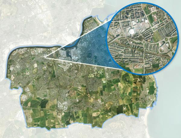
South Tyneside Council is using the latest aerial survey data from Bluesky to update essential Council records and inform decision making. By comparing the new photography with previous imagery, officers are even able to identify potential breaches of planning permission and land encroachment.
Flown in 2015 and delivered to the Council in early 2016, the Bluesky high resolution aerial photography is being deployed to specialist users in Planning and Highways, for example, within the Council’s desktop Geographical Information System (GIS) and, using standard web browser technology, across the organisation via the Council’s intranet. Plans are also in place to update the Council’s community website, giving residents and businesses in the area access to the Bluesky imagery.
“Unfortunately, due to budget restraints, we had not been able to update our aerial photography for several years,” said Andrew Tracey, Performance and Information Officer at South Tyneside Council. “So when funds became available in 2015, we were very keen to see what was on offer and bought the Bluesky 2015 survey.”
The Bluesky data is already being used across a number of strategic departments, including Planning, Highways and Asset Management. Users within Planning compare different ages of Bluesky imagery to identify suspected breaches of planning control, including developments that do not have the required planning permission as well as those that have failed to comply with conditions or limitations of granted permission. The Bluesky imagery can also be used as evidence when considering possible enforcement action.
The different ages of Bluesky imagery also help the Council identify and resolve boundary disputes where residents or businesses may have encroached on Council land, while other applications of the Bluesky data include use by Officers to identify and record features not referenced on traditional map layers, such as street furniture, road markings, street lights, trees and other Council assets.
Picture: Property and borders from above
Article written by Robin Snow | Published 17 June 2016
.png)

.png)
.png)

.jpg)


.jpg)